I check the OzWeather morning and night. My link bar always has Radar and Observations.
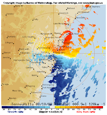
Recently the BoM (Bureau of Meteorology) opened a new radar station at Terrey Hills with add dopplar wind readings. I'm not going to go into the technical aspect to this (because I'm not that knowledgeable) but it does give a cool new view of wind around Sydney and with the crazy weather we've been having this week there is a lot to see.
Here is a snapshot of the wind right now in the Sydney region.
 Most of the time winds in Sydney would be around the light blue/yellow range at best so to see this much dark blue/red.
The thunderstorm that came through Wednesday night was also pretty intense in so far as the localised rainfall.
This is certainly the coldest October i can recall in sometime and a shock to the system after the hot humid weather in Hong Kong.
